Liste des lieux patrimoniaux du comté de Haldimand — Wikipédia
Cet article recense les lieux patrimoniaux du comté de Haldimand inscrits au répertoire des lieux patrimoniaux du Canada, qu'ils soient de niveau provincial, fédéral ou municipal.
Liste[modifier | modifier le code]
| [1] | Lieu patrimonial | Illustration | Adresse | Coordonnées | No | Constr. | Prot.[2] | Rec. | Notes |
|---|---|---|---|---|---|---|---|---|---|
| M | Caledonia Town Hall | 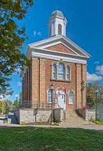 | 80, Caithness Street E. | 43.0731 -79.9488 | 10808 | 1857 | Municipal Heritage Designation (Part IV) | 1982 | |
| P | Caledonia Town Hall |  | 80, Caithness Street | 43.0731 -79.9488 | 18022 | 1857 | Ontario Heritage Foundation Easement | 1982 | |
| M | Campbell-Pine House | 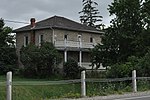 | 396, Highway #3 | 42.9454 -79.8454 | 10807 | 1847 | Municipal Heritage Designation (Part IV) | 1989 | |
| M | Charles Reicheld House |  | 601, Regional Road 12 | 42.8411 -79.888 | 10900 | 1886 | Municipal Heritage Designation (Part IV) | 1991 | |
| M | Cottonwood Mansion |  | 740, Regional Road 53 | 42.8185 -79.9251 | 10896 | Municipal Heritage Designation (Part IV) | 1989 | ||
| M | Cook-Peart House |  | 3355, River Road | 43.0034 -79.8789 | 10264 | Municipal Heritage Designation (Part IV) | 1989 | ||
| M | Cranston Post Office |  | 915, Regional Road 29 | 43.0075 -79.9511 | 10909 | Municipal Heritage Designation (Part IV) | 1991 | ||
| M | Dochstader Hotel |  | 3220, River Road | 43.0048 -79.879 | 10954 | Municipal Heritage Designation (Part IV) | 1989 | ||
| M | Duff House | 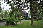 | 5, Mohawk Street E. | 42.9523 -79.8554 | 10957 | Municipal Heritage Designation (Part IV) | 1995 | ||
| M | Edmondson-Weaver House |  | 1613, Concession 13 | 42.8924 -80.1679 | 10976 | Municipal Heritage Designation (Part IV) | 1992 | ||
| M | Empire School |  | 3038, Regional Road 9 (York Rd.) | 43.0368 -79.9439 | 15226 | 1850 | Municipal Heritage Designation (Part IV) | 2000 | |
| M | Enniskillen Lodge |  | 39, Front Street | 43.0368 -79.9439 | 11108 | 1862 | Municipal Heritage Designation (Part IV) | 1983 | |
| M | Furry Tavern |  | 2511, North Shore Road | 42.924 -79.4779 | 10089 | 1821 | Municipal Heritage Designation (Part IV) | 2004 | |
| M | Gibson-Alderson House |  | 4830, Highway #6 | 43.059 -79.9682 | 10834 | Municipal Heritage Designation (Part IV) | 1989 | ||
| M | Gibson-Bunn Building | 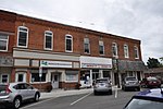 | 19, Cayuga Street N | 42.871 -79.7815 | 10098 | Municipal Heritage Designation (Part IV) | 2002 | ||
| M | Gypsum Mines School |  | 1256, Regional Road 17 | 42.9227 -79.7902 | 11000 | 1874 | Municipal Heritage Designation (Part IV) | 1986 | |
| M | Hoover Log House |  | 95, Concession 4 | 42.829 -79.9299 | 11109 | Municipal Heritage Designation (Part IV) | 2000 | ||
| M | Jeffrey Residence |  | 1615, Concession 13 | 42.8924 -80.1675 | 11141 | Municipal Heritage Designation (Part IV) | 1982 | ||
| M | John Fry House |  | 1915, Regional Road 3 | 42.8583 -79.6927 | 11142 | Municipal Heritage Designation (Part IV) | 1990 | ||
| M | Jones-Doughty Residence |  | 53, Talbot Street E. | 42.8851 -80.1094 | 11143 | 1865 | Municipal Heritage Designation (Part IV) | 1990 | |
| M | Kirkland House |  | 3062, River Road | 42.9133 -79.787 | 11144 | Municipal Heritage Designation (Part IV) | 1990 | ||
| M | Lalor Estate |  | 241, Broad Street W. | 42.9049 -79.6212 | 11149 | 1905 | Municipal Heritage Designation (Part IV) | 2004 | |
| M | McKinnon-Smith Residence |  | 156, Caithness Street E. | 43.0724 -79.9465 | 10931 | Municipal Heritage Designation (Part IV) | 1990 | ||
| M | Mooney Residence |  | 210, Broad St. W. | 42.9047 -79.6207 | 11164 | Municipal Heritage Designation (Part IV) | 2006 | ||
| M | Murray-Walton House and Farm |  | 266, Irish Line | 42.9287 -79.8655 | 11167 | Municipal Heritage Designation (Part IV) | 1995 | ||
| F | Nanticoke |  | 38, Rainham Road | 42.7973 -80.053 | 17701 | LHN | 1924 | ||
| M | Old Caledonia Mill | 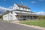 | 149, Forfar Street W. | 43.0717 -79.958 | 11169 | 1857 | Municipal Heritage Designation (Part IV) | 1983 | |
| F | Phare | 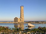 | Reserve nationale de la faune de l'île Mohawk | 42.8345 -79.5226 | 9770 | 1848 | Recognized Federal Heritage Building | 1993 | |
| P | Ruthven |  | 243, Highway 54 | 42.989 -79.8682 | 10564 | 1845 | Ontario Heritage Foundation Easement | 1996 | |
| P | Ruthven Gatehouse |  | 243, Highway # 54 | 42.9813 -79.8719 | 10547 | 1845 | Ontario Heritage Foundation Easement | 1996 | |
| F | Ruthven Park |  | 243 Highway 54 | 42.989 -79.8682 | 12099 | 1846 | LHN | 1995 | |
| M | Ruthven Park |  | 243, Highway 54 | 42.9684 -79.867 | 11134 | Municipal Heritage Designation (Part IV) | 1998 | ||
| M | Seneca Bridge |  | 651, Caithness Street E. | 43.0647 -79.9316 | 11173 | 1913 | Municipal Heritage Designation (Part IV) | 1984 | |
| M | St. John's Parish Hall |  | 0, Front Street | 43.0368 -79.9439 | 11176 | Municipal Heritage Designation (Part IV) | 1983 | ||
| M | The Gore School |  | 699, Haldimand Road 9 | 42.9616 -79.9717 | 11177 | 1882 | Municipal Heritage Designation (Part IV) | 1984 | |
| M | Thompson-Colwell House |  | 86, Sutherland Street E. | 43.0743 -79.9479 | 11178 | Municipal Heritage Designation (Part IV) | 1990 | ||
| M | Toll House | 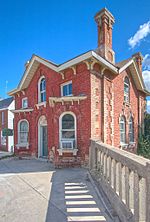 | 4, Argyle Street N. | 43.0734 -79.9518 | 10932 | 1875 | Municipal Heritage Designation (Part IV) | 1988 | |
| M | Union School |  | 34, Main St. W. | 42.8346 -79.9261 | 11179 | 1918 | Municipal Heritage Designation (Part IV) | 1983 | |
| M | Upper Farm Cemetery |  | 863, Keith Richardson Parkway | 42.8937 -80.1413 | 10606 | Municipal Heritage Designation (Part IV) | 1982 | ||
| M | Vanderburgh House |  | 4163, Highway 3 | 42.871 -79.7815 | 10869 | 1890 | Municipal Heritage Designation (Part IV) | 1990 | |
| M | Wilson Pugsley MacDonald Museum |  | 3513, Rainham Road | 42.9002 -80.004 | 10591 | 1872 | Municipal Heritage Designation (Part IV) | 1982 |
Notes et références[modifier | modifier le code]
- Niveau de la désignation: F: Fédéral, P: Provincial, M: Municipal
- (fr) Répertoire canadien des lieux patrimoniaux : Manuel de normes de documentation, Annexe A : Vocabulaires contrôlés, p.59-78
(en) Canadian Register of Historic Places: Documentation Standards Handbook, Appendix A: Controlled Vocabulary, p.57-75
Annexes[modifier | modifier le code]
Articles connexes[modifier | modifier le code]
Liens externes[modifier | modifier le code]
Pour l'ensemble des points mentionnés sur cette page : voir sur OpenStreetMap (aide), Bing Cartes (aide) ou télécharger au format KML (aide).
- « Lieux patrimoniaux du Canada »
- « Annuaire des désignations patrimoniales fédérales », sur Parcs Canada


 French
 Deutsch