Ouarkoye (département) — Wikipédia
| Ouarkoye | |||
| Administration | |||
|---|---|---|---|
| Pays | |||
| Région | Boucle du Mouhoun | ||
| Province | Mouhoun | ||
| Statut | Département Commune rurale | ||
| Chef-lieu | Ouarkoye | ||
| Démographie | |||
| Population | 38 830 hab. (2006) | ||
| Géographie | |||
| Coordonnées | 12° 05′ 00″ nord, 3° 40′ 00″ ouest | ||
| Divers | |||
| Fuseau horaire | UTC +0 | ||
| Indicatif téléphonique | +226 | ||
| Localisation | |||
 Carte des départements de la province de Mouhoun. | |||
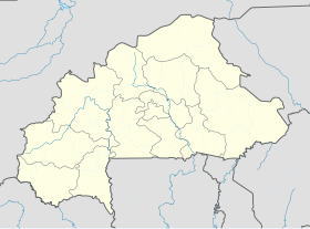
| Géolocalisation sur la carte : Burkina Faso Géolocalisation sur la carte : Burkina Faso | |||
| modifier | |||
Ouarkoye est un département et une commune rurale de la province du Mouhoun, situé dans la région de la Boucle du Mouhoun au Burkina Faso. Il compte en 2006, 38 830 habitants[1].
Villages
[modifier | modifier le code]Le département de Ouarkoye comprend un village chef-lieu[2] (données de 2006) :
- Ouarkoye (2 979 habitants)
et vingt-trois autres villages :
- Békuy (736 habitants)
- Dankuy (2159 habitants)
- Darou (539 habitants)
- Doudou (3 015 habitants)
- Fakéna (ou Dakéna) (4 373 habitants)
- Fouankuy (1 092 habitants)
- Kamako (150 habitants)
- Kékaba (ou Kékéba) (1 667 habitants)
- Koena (1 640 habitants)
- Kosso (4 537 habitants)
- Kouankuy (1 321 habitants)
- Lokindé (227 habitants)
- Miana (531 habitants)
- Monkuy (3 141 habitants)
- Ouanabékuy (1 697 habitants)
- Oué (270 habitants)
- Pérakuy (254 habitants)
- Poundou (4 049 habitants)
- Samakuy (400 habitants)
- Soana (673 habitants)
- Sokongo (1 430 habitants)
- Syn n°1 (305 habitants)
- Tiokuy (1 645 habitants)
Notes et références
[modifier | modifier le code]- « État et structure de la population, Tableau 1.1 : Répartition de la population résidente par commune selon le sexe », sur insd.bf (consulté le )
- Données démographiques sur le site des communes du Burkina Faso.


 French
 Deutsch

