Wheatfield (Indiana) — Wikipédia
Wheatfield
| Pays | |
|---|---|
| État | |
| Comté | |
| Canton | Wheatfield Township (en) |
| Superficie | 1,44 km2 () |
| Surface en eau | 0 % |
| Altitude | 202 m |
| Coordonnées |
| Population | 904 hab. () |
|---|---|
| Densité | 627,8 hab./km2 () |
| Statut |
|---|
| Code postal | 46392 |
|---|---|
| Code FIPS | 18-83528 |
| GNIS | |
| Indicatif téléphonique | 219 |
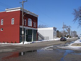
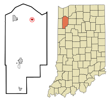
Wheatfield est une municipalité américaine située dans le comté de Jasper en Indiana.
Lors du recensement de 2010, sa population est de 853 habitants[1]. La municipalité s'étend sur 0,56 mille carré (1,45 km2)[1].
Wheatfield est fondée en 1858[2]. Elle devient un important centre agricole après le drainage des marais alentour et l'arrivée du Plymouth, Kankakee and Pacific Railway dans les années 1880[3]. Son nom fait référence à ses terres propices à la culture du blé (en anglais : wheat)[2].
Notes et références
[modifier | modifier le code]- (en) Bureau du recensement des États-Unis, « Population, Housing Units, Area, and Density: 2010 - State -- Place and (in selected states) County Subdivision 2010 Census Summary File 1 », sur factfinder.census.gov (consulté le ).
- (en) Ronald L. Baker, From Needmore to Prosperity: Hoosier Place Names in Folklore and History, Indiana University Press, (lire en ligne), p. 345.
- (en) Louis H. Hamilton et William Darroch, A Standard History of Jasper and Newton Counties, Indiana: An Authentic Narrative of the Past, with an Extended Survey of Modern Developments in the Progress of Town and Country, vol. 1, The Lewis Publishing Company, (lire en ligne), p. 166.


 French
 Deutsch

