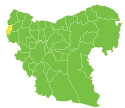
Distretto di Afrin
| Distretto di Afrin distretto | |
|---|---|
| عفرين | |
| Localizzazione | |
| Stato | |
| Governatorato | Aleppo |
| Amministrazione | |
| Capoluogo | Afrin |
| Territorio | |
| Coordinate del capoluogo | 36°30′43.97″N 36°51′50.43″E |
| Superficie | 1 840,85[1] km² |
| Abitanti | 172 095[2] (stima 2009) |
| Densità | 93,49 ab./km² |
| Altre informazioni | |
| Fuso orario | UTC+2 |
| Cartografia | |
 | |
Il distretto di Afrin (in arabo عفرين? è un distretto Siriano e fa parte del governatorato di Aleppo.
Al censimento del 2004 aveva una popolazione di 172.095.
Il suo centro amministrativo è la città di Afrin.
Geografia
[modifica | modifica wikitesto]Ad est il distretto confina con A'zaz, verso sud con il Monte Simeone e verso ovest e il nord il confine con la Turchia costituisce un confine internazionale (province turche di Hatay, Kilis, Gaziantep).
Sub-Distretti
[modifica | modifica wikitesto]The administrative center of Afrin Subdistrict shown above is the city of Afrin.
The administrative center of Jindires Subdistrict shown above is the city of Jindires.
The administrative center of Shaykh al-Hadid Subdistrict shown above is the city of Shaykh al-Hadid.
The administrative center of Maabatli Subdistrict shown above is the city of Maabatli.
The administrative center of Sharran Subdistrict shown above is the city of Sharran.
The administrative center of Bulbul Subdistrict shown above is the city of Bulbul.
The administrative center of Rajo Subdistrict shown above is the city of Rajo.
Il Distretto di Afrin è suddiviso in 7 sub-distretti o Nāḥiyas:
- Afrin nahiyah (ناحية عفرين),
- Bulbul nahiyah (ناحية بلبل),
- Jindires nahiyah (ناحية جنديرس),
- Rajo nahiyah (ناحية راجو)
- Sharran nahiyah (ناحية شرّان),
- Shaykh al-Hadid nahiyah (ناحية شيخ الحديد)
- Maabatli nahiyah (ناحية معبطلي)
Note
[modifica | modifica wikitesto]Collegamenti esterni
[modifica | modifica wikitesto]- Alèppo (distretto), su sapere.it, De Agostini.


 French
 Deutsch


