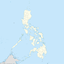
クリオン (パラワン州)
Culion クリオン | |
|---|---|
 | |
 | |
| 北緯11度49分 東経119度52分 / 北緯11.817度 東経119.867度座標: 北緯11度49分 東経119度52分 / 北緯11.817度 東経119.867度 | |
| 国 | フィリピン |
| 地方 | ミマロパ地方 (Region IV-B) |
| 州 | パラワン州 |
| バランガイ | 14 |
| Incorporated | 1992 |
| 政府 | |
| • Mayor | Veronica Cantimbuhan |
| 面積 | |
| • 合計 | 1,191.39 km2 |
| • 陸地 | 415 km2 |
| 最高標高 | 460 m |
| 最低標高 | 0 m |
| 人口 (2006年)3,082世帯 | |
| • 合計 | 18,000人 |
| • 密度 | 43.4人/km2 |
| 等時帯 | UTC+8 (PST) |
| ウェブサイト | culion.org |
クリオン(Culion)は、クリオン島及び41の島を含む、フィリピンパラワン州の地域[1] [2]

地域
[編集]バランガイ(行政地域)数: 14
- Balala
- Baldat
- Binudac
- Culango
- Galoc
- Jardin
- Libis
- Luac
- Malaking Patag
- Osmeña
- Tiza
- De Carabao
- Burabod
- Halsey
年表
[編集]- 1906年、クリオン島にハンセン病療養所開設。 同年5月27日に、370名のハンセン病患者がセブより2隻の沿岸警備隊カッター船ポリリオ号(the Polilio)、ミンダナオ号(the Mindanao)により移送される。
- 1934年、患者数6,500人(当時のハンセン病療養所で世界最大)
- 1992年、地方自治体になる
- 2006年、旧ハンセン病療養所研究棟が資料館として公開
参照
[編集]- ^ “Culion Island”. Encyclopedia Britannica. April 7, 2011閲覧。
- ^ Ronald Fettes Chapman (1982). Leonard Wood and leprosy in the Philippines: the Culion Leper Colony, 1921-1927. University Press of America. pp. 85–86. ISBN 0819119776 April 7, 2011閲覧。.


 French
 Deutsch