サワチ郡 (コロラド州)
| コロラド州サワチ郡 | |
|---|---|
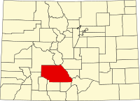
 郡のコロラド州内の位置 | |
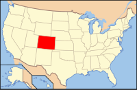
 州のアメリカ合衆国内の位置 | |
| 設立 | 1866年12月29日 |
| 郡庁所在地 | サワチ |
| 最大のtown | センター |
| 面積 - 総面積 - 陸 - 水 | 8,211 km2 (3,170.25 mi2) 8,206 km2 (3,168.44 mi2) 5 km2 (1.82 mi2), 0.06% |
| 人口 - (2010年) - 密度 | 6,108人 1人/km2 (2人/mi2) |
| 標準時 | 山岳部標準時: -7/-6 |
| ウェブサイト | www |
サワチ郡(サワチぐん、英: Saguache County、[səˈwætʃ][1])は、アメリカ合衆国コロラド州の中央部南西に位置する郡である。2010年国勢調査での人口は6,108人であり、2000年の5,917人から3.2%増加した[2][3]。面積ではコロラド州の郡で第7位である。郡庁所在地はサワチ(人口485人[4])であり[5]、同郡で人口最大の町はセンター(人口2,230人[6])である。郡内に法人化された都市は無く、4つの法人化町があるだけである。郡名はユト語の「青い地球」あるいは「青い大地の水」を意味する言葉から採られた。
地理
[編集]アメリカ合衆国国勢調査局に拠れば、郡域全面積は3,170.25平方マイル (8,210.9 km2)であり、このうち陸地は3,168.44平方マイル (8,206.2 km2)、水域は1.82平方マイル (4.7 km2)で水域率は0.06%である[7]。
隣接する郡
[編集]- チャフィー郡 - 北
- フレモント郡 - 北東
- カスター郡 - 東
- ヒューファノ郡 - 南東
- リオグランデ郡 - 南
- アラモサ郡 - 南
- ミネラル郡 - 南西
- ヒンズデール郡 - 南西
- ガニソン郡 - 北西
人口動態
[編集]| 基礎データ
人種別人口構成
年齢別人口構成
| 世帯と家族(対世帯数)
収入[編集]収入と家計 |
都市と町
[編集]
国立公園[編集]国有林と原生地[編集]
トレイル[編集]
| グレートサンドデューンズ国立公園の中のトレイル[編集]
自転車道[編集]
|
アメリカ合衆国国家歴史登録財
[編集]サワチ郡でアメリカ合衆国国家歴史登録財に登録されている場所のリスト[10]
| No. | 名称 | 登録日 | 位置 | 都市または町 |
|---|---|---|---|---|
| 1 | カピラ・デ・サンフアン・バウティスタ | 1980年2月8日 | ラガリータの北西 北緯37度51分1秒 西経106度15分46秒 / 北緯37.85028度 西経106.26278度 | ラガリータ |
| 2 | カルネロ・クリーク絵文字 | 1975年6月5日 | - | ラガリータ |
| 3 | クレストーン学校 | 1986年1月9日 | コットンウッド通りとカーボネイト・アベニュー 北緯37度59分48秒 西経105度41分57秒 / 北緯37.99667度 西経105.69917度 | クレストーン |
| 4 | モファット最初のバプテスト教会 | 2008年7月24日 | リンカーン・アベニュー401 | モファット |
| 5 | インディアン・グローブ | 2000年3月24日 | - | モスカ |
| 6 | サワチ製粉所 | 1978年9月18日 | サワチ西部 北緯38度4分53秒 西経106度9分38秒 / 北緯38.08139度 西経106.16056度 | サワチ |
| 7 | サワチ学校および刑務所 | 1975年5月2日 | アメリカ国道285号線とサンフアン・アベニュー 北緯38度5分16秒 西経106度8分38秒 / 北緯38.08778度 西経106.14389度 | サワチ |
脚注
[編集]- ^ Saguache is pronounced [səˈwætʃ]. この名前はユト語の「青い地球」あるいは「青い大地の水」を意味する言葉である。スペイン語では Saguache と綴られるが、英語では“Sawatch”と綴られるのが普通である。
- ^ Quickfacts.census.gov - Saguache County - accessed 2011-12-06.
- ^ “Annual County Population Estimates and Estimated Components of Change: April 1, 2000 to July 1, 2006 (CO-EST2006-alldata)” (CSV). 2006 Population Estimates. United States Census Bureau, Population Division (2007年3月22日). 2007年5月17日閲覧。
- ^ American FactFinder. U.S. Census Bureau. - Saguache, Colorado] - accessed 2011-12-06.
- ^ Find a County, National Association of Counties 2011年6月7日閲覧。
- ^ American FactFinder. U.S. Census Bureau. - Center, Colorado] - accessed 2011-12-06.
- ^ “Census 2000 U.S. Gazetteer Files: Counties”. United States Census. 2011年2月13日閲覧。
- ^ "Forest Service issues management plan for Baca Mountain Tract:" Creation of Great Sand Dunes National Park gave 14,000-acre parcel to Forest Service." article by Matt Hildner in The Pueblo Chieftain November 14, 2009, Updated May 11, 2010, accessed August 30, 2010
- ^ Hiking and Backpacking accessed July 16, 2010
- ^ List generated using the tool "Create a Wiki-formatted table of National Register properties in a given county" at "National Register Tools" "The data here was downloaded from the National Register Information System with a date of March 13, 2009" Accessed July 15, 2010
参考文献
[編集]- Lindsey, D.A. et al. (1985). Mineral resources of the Black Canyon and South Piney Creek Wilderness Study Areas, Saguache County, Colorado [U.S. Geological Survey Bulletin 1716-A]. Washington, D.C.: U.S Department of the Interior, U.S. Geological Survey.
外部リンク
[編集]- Saguache County Government website - 公式サイト
- Crestone and Saguache County Visitor's Agency website
- Colorado County Evolution by Don Stanwyck
- Colorado Historical Society
 | ガニソン郡 | チャフィー郡 | フレモント郡 |  |
| カスター郡 | ||||
| ヒンズデール郡、ミネラル郡 | リオグランデ郡、アラモサ郡 | ヒューファノ郡 |


 French
 Deutsch