Aylesbury Vale
| Niet-metropolitaans district in Engeland | |||
|---|---|---|---|
  | |||
| Situering | |||
| Land | Engeland | ||
| County | Buckinghamshire | ||
| Regio | South East England | ||
| Coördinaten | 51°53'28"NB, 0°54'43"WL | ||
| Algemeen | |||
| Oppervlakte | 902,7533[1] km² | ||
| Inwoners (2018[2]) | 199.448 (221 inw./km²) | ||
| ONS-code | E07000004 | ||
| Website | www | ||
| Detailkaart | |||
 | |||
| |||
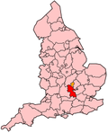
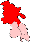
Aylesbury Vale is een Engels district in het shire county (non-metropolitan county OF county) Buckinghamshire en telt 199.000 inwoners. De oppervlakte bedraagt 903 km².
Van de bevolking is 12,8% ouder dan 65 jaar. De werkloosheid bedraagt 2,0% van de beroepsbevolking (cijfers volkstelling 2001).
Civil parishes in district Aylesbury Vale
[bewerken | brontekst bewerken]Addington, Adstock, Akeley, Ashendon, Aston Abbotts, Aston Clinton, Aston Sandford, Aylesbury, Barton Hartshorn, Beachampton, Biddlesden, Bierton with Broughton, Boarstall, Brill, Buckingham, Buckingham Park, Buckland, Calvert Green, Charndon, Chearsley, Cheddington, Chetwode, Chilton, Coldharbour, Creslow, Cublington, Cuddington, Dinton-with-Ford and Upton, Dorton, Drayton Beauchamp, Drayton Parslow, Dunton, East Claydon, Edgcott, Edlesborough, Fleet Marston, Foscott, Gawcott with Lenborough, Granborough, Great Brickhill, Great Horwood, Grendon Underwood, Haddenham, Halton, Hardwick, Hillesden, Hoggeston, Hogshaw, Hulcott, Ickford, Ivinghoe, Kingsey, Kingswood, Leckhampstead, Lillingstone Dayrell with Luffield Abbey, Lillingstone Lovell, Little Horwood, Long Crendon, Ludgershall, Maids Moreton, Marsh Gibbon, Marsworth, Mentmore, Middle Claydon, Mursley, Nash, Nether Winchendon, Newton Longville, North Marston, Oakley, Oving, Padbury, Pitchcott, Pitstone, Poundon, Preston Bissett, Quainton, Quarrendon, Radclive-cum-Chackmore, Shabbington, Shalstone, Slapton, Soulbury, Steeple Claydon, Stewkley, Stoke Hammond, Stoke Mandeville, Stone with Bishopstone and Hartwell, Stowe, Swanbourne, Thornborough, Thornton, Tingewick, Turweston, Twyford, Upper Winchendon, Waddesdon, Water Stratford, Watermead, Weedon, Wendover, Westbury, Westcott, Weston Turville, Whaddon, Whitchurch, Wing, Wingrave with Rowsham, Winslow, Woodham, Worminghall, Wotton Underwood.
- ↑ Office for National Statistics → Download → SAM_for_Administrative_Areas_(2018).zip → SAM_LAD_DEC_2018_UK.xlsx. Gearchiveerd op 7 april 2023.
- ↑ https://www.ons.gov.uk/file?uri=/peoplepopulationandcommunity/populationandmigration/populationestimates/datasets/populationestimatesforukenglandandwalesscotlandandnorthernireland/mid20182019laboundaries/ukmidyearestimates20182019ladcodes.xls Schatting Office for National Statistics: knop MYE5 → kolom Estimated Population mid-2018]


 French
 Deutsch