Hambleton (district)
| Niet-metropolitaans district in Engeland | |||
|---|---|---|---|
  | |||
| Situering | |||
| Land | Engeland | ||
| County | North Yorkshire | ||
| Regio | Yorkshire and the Humber | ||
| Coördinaten | 54°20'2"NB, 1°25'44"WL | ||
| Algemeen | |||
| Oppervlakte | 1311,2282[1] km² | ||
| Inwoners (2018[2]) | 91.134 (70 inw./km²) | ||
| Hoofdplaats ONS-code | Northallerton E07000164 | ||
| Website | hambleton | ||
| Detailkaart | |||
 | |||
| |||
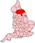
Hambleton is een Engels district in het shire-graafschap (non-metropolitan county OF county) North Yorkshire en telt 84.111 inwoners. De oppervlakte bedraagt 1311 km².
Van de bevolking is 17,5% ouder dan 65 jaar. De werkloosheid bedraagt 2,0% van de beroepsbevolking (cijfers volkstelling 2001).
Civil parishes in district Hambleton
[bewerken | brontekst bewerken]Ainderby Miers with Holtby, Ainderby Quernhow, Ainderby Steeple, Aiskew, Aldwark, Alne, Angram Grange, Appleton Wiske, Bagby, Balk, Bedale, Beningbrough, Bilsdale Midcable, Birdforth, Birkby, Boltby, Borrowby, Brafferton, Brandsby-cum-Stearsby, Brompton, Burneston, Burrill with Cowling, Carlton, Carlton Husthwaite, Carlton Miniott, Carthorpe, Catton, Clifton-on-Yore, Cotcliffe, Cowesby, Coxwold, Crakehall, Crathorne, Crayke, Crosby, Dalby-cum-Skewsby, Dalton, Danby Wiske with Lazenby, Deighton, Easby, Easingwold, East Cowton, East Harlsey, East Rounton, East Tanfield, Eldmire with Crakehill, Ellerbeck, Exelby, Leeming and Newton, Faceby, Farlington, Fawdington, Felixkirk, Firby, Flawith, Gatenby, Girsby, Great Ayton, Great Busby, Great Langton, Great Smeaton, Great and Little Broughton, Hackforth, Helperby, High Worsall, Holme, Hood Grange, Hornby, Howe, Howgrave, Huby, Husthwaite, Hutton Bonville, Hutton Rudby, Hutton-Sessay, Ingleby Arncliffe, Ingleby Greenhow, Kepwick, Kilburn High and Low, Kildale, Killerby, Kiplin, Kirby Knowle, Kirby Sigston, Kirby Wiske, Kirkby, Kirkby Fleetham with Fencote, Kirklington-cum-Upsland, Knayton with Brawith, Landmoth-cum-Catto, Langthorne, Leake, Linton-on-Ouse, Little Ayton, Little Busby, Little Langton, Little Smeaton, Low Worsall, Marton-cum-Moxby, Maunby, Middleton-on-Leven, Morton-on-Swale, Myton-on-Swale, Nether Silton, Newburgh, Newby, Newby Wiske, Newsham with Breckenbrough, Newton-on-Ouse, North Kilvington, North Otterington, Northallerton, Osmotherley, Oulston, Over Dinsdale, Over Silton, Overton, Pickhill with Roxby, Picton, Potto, Rand Grange, Raskelf, Romanby, Rookwith, Rudby, Sandhutton, Scruton, Seamer, Sessay, Sexhow, Shipton, Sinderby, Skipton-on-Swale, Skutterskelfe, Snape with Thorp, South Cowton, South Kilvington, South Otterington, Sowerby, Sowerby-under-Cotcliffe, Stillington, Stokesley, Sutton with Howgrave, Sutton-on-the-Forest, Sutton-under-Whitestonecliffe, Swainby with Allerthorpe, Theakston, Thimbleby, Thirkleby High and Low with Osgodby, Thirlby, Thirn, Thirsk, Tholthorpe, Thormanby, Thornbrough, Thornton Watlass, Thornton-le-Beans, Thornton-le-Moor, Thornton-le-Street, Thornton-on-the-Hill, Thrintoft, Tollerton, Topcliffe, Upsall, Warlaby, Welbury, Well, West Harsley, West Rounton, West Tanfield, Whenby, Whitwell, Whorlton, Wildon Grange, Winton, Stank and Hallikeld, Yafforth, Yearsley, Youlton.
- ↑ Office for National Statistics → Download → SAM_for_Administrative_Areas_(2018).zip → SAM_LAD_DEC_2018_UK.xlsx. Gearchiveerd op 12 juni 2023.
- ↑ https://www.ons.gov.uk/file?uri=/peoplepopulationandcommunity/populationandmigration/populationestimates/datasets/populationestimatesforukenglandandwalesscotlandandnorthernireland/mid20182019laboundaries/ukmidyearestimates20182019ladcodes.xls Schatting Office for National Statistics: knop MYE5 → kolom Estimated Population mid-2018]


 French
 Deutsch