Chitral - Simple English Wikipedia, the free encyclopedia
Chitral چترال | |
|---|---|
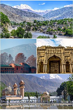
 Clockwise from top: view of Chitral valley and snowcapped peak of Tirich Mir, Chitral's Shahi Qilla, Shahi Mosque, Chitral Fort | |
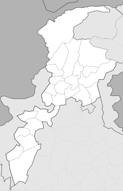
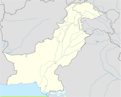
| Coordinates: 35°50′46″N 71°47′09″E / 35.84611°N 71.78583°E | |
| Country | Pakistan |
| Province | Khyber Pakhtunkhwa |
| District | Chitral District |
| Government | |
| • Body | MNA |
| • MNA (NA-32) | Moulana Abdul Akbar Chitrali (APML)[1] |
| Area | |
| • Total | 35.9 km2 (13.9 sq mi) |
| Elevation | 1,517 m (4,977 ft) |
| Languages | |
| • Official | Chitrali |
| • Native | Urdu |
| Time zone | UTC+5 (PST) |
| PIN | 1720 – 0xx[4] |
| Website | chitral |
Chitral (Urdu: چترال, is the valley of the Chitral District in Pakistan. It is on the western bank of the Chitral River. It has a population of 20,000. Chitrali language is native language. It has total area size of 35.9 km.
History
[change | change source]Chitral has for millennia been an important point on the trade routes from northern Afghanistan (ancient Bactria) and the Tarim Basin to the plains of Gandhara (in northern Pakistan), and the region near Jalalabad, in eastern Afghanistan.
References
[change | change source]- ↑ "Personal Profile". na.gov.pk. National Assembly of Pakistan. Retrieved 24 October 2023.
- ↑ https://ppaspk.org/index.php/PPAS-A/article/download/1098/647&ved=2ahUKEwivnKW2xY6CAxWOTKQEHaR_A_8QFnoECDgQAQ&usg=AOvVaw0U6E7LOxiIau4JySUVla4z
- ↑ "Geography of Chitral". Chitralnews.com. Archived from the original on 2018-10-09. Retrieved 2015-11-06.
- ↑ "Post Codes". Pakistan Post Office. Archived from the original on 20 December 2011. Retrieved 17 March 2015.
Other websites
[change | change source]Wikivoyage has a travel guide about: Chitral
Wikimedia Commons has media related to Chitral.


 French
 Deutsch
