Moriarty, New Mexico - Simple English Wikipedia, the free encyclopedia
Moriarty, New Mexico | |
|---|---|
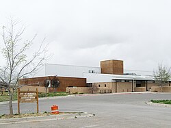
 Moriarty Civic Center | |
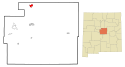
 Location of Moriarty, New Mexico | |
 Lisa's Truck Center | |
| Coordinates: 34°59′35″N 106°02′40″W / 34.99306°N 106.04444°W | |
| Country | United States |
| State | New Mexico |
| County | Torrance |
| Area | |
| • Total | 6.93 sq mi (17.96 km2) |
| • Land | 6.93 sq mi (17.96 km2) |
| • Water | 0.00 sq mi (0.00 km2) |
| Elevation | 6,224 ft (1,897 m) |
| Population | |
| • Total | 1,946 |
| • Density | 280.61/sq mi (108.35/km2) |
| Time zone | UTC-7 (Mountain (MST)) |
| • Summer (DST) | UTC-6 (MDT) |
| ZIP code | 87035 |
| Area code | 505 |
| FIPS code | 35-50160 |
| GNIS feature ID | 2411165[2] |
| Website | www |
Moriarty is a city in Torrance County, New Mexico, United States. The population was 1,946 at the 2020 Census.[3] It is part of the Albuquerque Metropolitan Statistical Area.
Moriarty is located at 35°00′00″N 106°2′48″W / 35.00000°N 106.04667°W (34.999815, -106.046667).[4]
References
[change | change source]- ↑ "ArcGIS REST Services Directory". United States Census Bureau. Retrieved October 12, 2022.
- ↑ 2.0 2.1 U.S. Geological Survey Geographic Names Information System: Moriarty, New Mexico
- ↑ 3.0 3.1 "Profile of General Population and Housing Characteristics: 2020 Demographic Profile Data (DP-1): Moriarty city, New Mexico". United States Census Bureau. Retrieved March 14, 2024.
- ↑ "US Gazetteer files: 2010, 2000, and 1990". United States Census Bureau. 2011-02-12. Retrieved 2011-04-23.


 French
 Deutsch