Uniontown, Kansas - Simple English Wikipedia, the free encyclopedia
Uniontown, Kansas | |
|---|---|
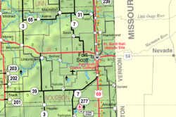
 Location within Bourbon County and Kansas | |
 | |
| Coordinates: 37°50′50″N 94°58′32″W / 37.84722°N 94.97556°W[1] | |
| Country | United States |
| State | Kansas |
| County | Bourbon |
| Incorporated | 1895 |
| Named for | Union |
| Area | |
| • Total | 0.21 sq mi (0.55 km2) |
| • Land | 0.21 sq mi (0.55 km2) |
| • Water | 0.00 sq mi (0.00 km2) |
| Elevation | 889 ft (271 m) |
| Population | |
| • Total | 293 |
| • Density | 1,400/sq mi (530/km2) |
| Time zone | UTC-6 (CST) |
| • Summer (DST) | UTC-5 (CDT) |
| ZIP code | 66779 |
| Area code | 620 |
| FIPS code | 20-72525 |
| GNIS ID | 2397088[1] |
| Website | cityofuniontown.net |
Uniontown is a city in Bourbon County, Kansas, United States. In 2020, 293 people lived there.[3]
History
[change | change source]A post office was created in 1856 about two miles east of the town. Uniontown was moved to its current place around 1865.[4] The early settlers were loyal to the Union in the Civil War. The city was named after the Union.[5] Throughout the twentieth century the town was served by the Missouri Pacific Railroad.
Geography
[change | change source]Uniontown is at 37°50′50″N 94°58′32″W / 37.84722°N 94.97556°W (37.847198, -94.975688). It is along the Marmaton River. The United States Census Bureau says that the city has a total area of 0.21 square miles (0.54 km2). All of it is land.[2]
People
[change | change source]| Historical population | |||
|---|---|---|---|
| Census | Pop. | %± | |
| 1880 | 136 | — | |
| 1890 | 344 | 152.9% | |
| 1900 | 293 | −14.8% | |
| 1910 | 256 | −12.6% | |
| 1920 | 300 | 17.2% | |
| 1930 | 298 | −0.7% | |
| 1940 | 277 | −7.0% | |
| 1950 | 232 | −16.2% | |
| 1960 | 211 | −9.1% | |
| 1970 | 286 | 35.5% | |
| 1980 | 371 | 29.7% | |
| 1990 | 290 | −21.8% | |
| 2000 | 288 | −0.7% | |
| 2010 | 272 | −5.6% | |
| 2020 | 293 | 7.7% | |
| U.S. Decennial Census | |||
2020 census
[change | change source]The 2020 census says that there were 293 people, 107 households, and 68 families living in Uniontown. Of the households, 79.4% owned their home and 20.6% rented their home.
The median age was 31.1 years. Of the people, 91.8% were White, 2.0% were Native American, 0.7% were Asian, and 5.5% were two or more races. Hispanic or Latino of any race were 2.0% of the people.[3][6]
2010 census
[change | change source]The 2010 census says that there were 272 people, 120 households, and 66 families living in Uniontown.[7]
References
[change | change source]- ↑ 1.0 1.1 1.2 U.S. Geological Survey Geographic Names Information System: Uniontown, Kansas
- ↑ 2.0 2.1 "2020 U.S. Gazetteer Files". United States Census Bureau. Retrieved November 20, 2023.
- ↑ 3.0 3.1 3.2 "DP1: PROFILE OF GENERAL POPULATION AND HOUSING CHARACTERISTICS". United States Census Bureau. Retrieved November 20, 2023.
- ↑ Blackmar, Frank Wilson (1912). Kansas: A Cyclopedia of State History, Volume 2. Standard Publishing Company. p. 826.
- ↑ Capace, Nancy (1 June 2000). Encyclopedia of Kansas. North American Book Dist LLC. p. 282. ISBN 978-0-403-09312-0.
- ↑ "P16: HOUSEHOLD TYPE". United States Census Bureau. Retrieved January 2, 2024.
- ↑ "American FactFinder". United States Census Bureau. Retrieved 2012-07-06.
Other websites
[change | change source]- City
- Schools
- USD 235, local school district
- Maps
- Uniontown City Map, KDOT


 French
 Deutsch