根特崗日峰 - 维基百科,自由的百科全书
| 根特崗日峰 | |
|---|---|
| 别名 | Ghent Kangri |
| 最高点 | |
| 海拔 | 7,401米(24,281英尺) 世界第69高 |
| 地形突起度 | 1,493米(4,898英尺) |
| 坐标 | 35°31′03″N 76°48′01″E / 35.51750°N 76.80028°E |
| 地理 | |
| 位置 | 印度与巴基斯坦争议地区[1] |
| 所属山脉 | 喀喇崑崙山脈,薩爾托洛山脈 |
| 攀山 | |
| 首次登頂 | 1961年:Wolfgang Axt |
| 最简路线 | 西线:冰川、雪地攀登 |
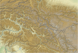
根特崗日峰(Ghent Kangri)是巴基斯坦与印度在印巴停火线的山峰,位於錫亞琴冰川的西面,屬於喀喇崑崙山脈的一部分,海拔高度7,401米,是全球第69高山峰,奧地利攀山隊在1961年6月4日首次登上該山峰。
参考
[编辑]- Jill Neate, High Asia: an illustrated history of the 7,000 metre peaks, The Mountaineers, 1989.
- Jerzy Wala, Orographical Sketch Map of the Karakoram, Swiss Foundation for Alpine Research, 1990.
| 这是一篇關於巴基斯坦的地理小作品。您可以通过编辑或修订扩充其内容。 |
| 这是一篇有关印度地理的小作品。您可以通过编辑或修订扩充其内容。 |
喀喇昆仑山脉主要山峰的位置图
图例:
![]() 1:喬戈里峰
1:喬戈里峰 ![]() 2:加舒尔布鲁木I峰 K5
2:加舒尔布鲁木I峰 K5 ![]() 3:布洛阿特峰
3:布洛阿特峰 ![]() 4:加舒尔布鲁木II峰 K4
4:加舒尔布鲁木II峰 K4 ![]() 5:加舒尔布鲁木III峰 K3a
5:加舒尔布鲁木III峰 K3a
![]() 6:加舒尔布鲁木IV峰 K3
6:加舒尔布鲁木IV峰 K3 ![]() 7:迪斯特吉峰
7:迪斯特吉峰 ![]() 8:昆扬基什峰
8:昆扬基什峰 ![]() 9:玛夏布洛姆峰 K1
9:玛夏布洛姆峰 K1 ![]() 10:巴托拉I峰
10:巴托拉I峰
![]() 11:拉卡波希峰
11:拉卡波希峰 ![]() 12:巴托拉II峰
12:巴托拉II峰 ![]() 13:坎巨提峰
13:坎巨提峰 ![]() 14:萨尔托洛岗日峰 K10
14:萨尔托洛岗日峰 K10 ![]() 15:巴托拉III峰
15:巴托拉III峰
![]() 16:莎瑟I峰 K22
16:莎瑟I峰 K22 ![]() 17:乔戈里萨峰
17:乔戈里萨峰 ![]() 18:喜士帕尔峰
18:喜士帕尔峰 ![]() 19:Trivor Sar
19:Trivor Sar ![]() 20:斯坎格里峰
20:斯坎格里峰
![]() 21:玛莫斯通岗日峰 K35
21:玛莫斯通岗日峰 K35 ![]() 22:莎瑟II峰
22:莎瑟II峰 ![]() 23:莎瑟III峰
23:莎瑟III峰 ![]() 24:普马里基什峰
24:普马里基什峰 ![]() 25:帕苏峰
25:帕苏峰
![]() 26:雅克辛嘎丹峰
26:雅克辛嘎丹峰 ![]() 27:特拉木坎力I峰
27:特拉木坎力I峰 ![]() 28:马鲁毕庭峰
28:马鲁毕庭峰 ![]() 29:K12
29:K12 ![]() 30:锡亚康戈里峰
30:锡亚康戈里峰
![]() 31:莫慕希尔峰
31:莫慕希尔峰 ![]() 32:斯吉尔布鲁木峰
32:斯吉尔布鲁木峰 ![]() 33:哈拉莫什峰
33:哈拉莫什峰 ![]() 34:根特岗日峰
34:根特岗日峰 ![]() 35:乌尔塔峰
35:乌尔塔峰
![]() 36:里莫I峰
36:里莫I峰 ![]() 37:舍披岗日峰
37:舍披岗日峰 ![]() 38:Yazghil Dome South
38:Yazghil Dome South ![]() 39:巴尔托洛岗日峰
39:巴尔托洛岗日峰 ![]() 40:皇冠山
40:皇冠山
![]() 41:拜塔布拉克峰
41:拜塔布拉克峰 ![]() 42:Yutmaru Sar
42:Yutmaru Sar ![]() 43:巴尔蒂斯坦峰 K6
43:巴尔蒂斯坦峰 K6 ![]() 44:慕士塔格塔峰
44:慕士塔格塔峰 ![]() 45:迪让峰
45:迪让峰
![]() 46:Apsarasas Kangri I
46:Apsarasas Kangri I ![]() 47:里莫III峰
47:里莫III峰 ![]() 48:加舒尔布鲁木V峰
48:加舒尔布鲁木V峰


 French
 Deutsch
