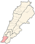
Ain Baal
Ain Baal عين بعال | |
|---|---|
Municipality | |
 | |
| Coordinates: 33°14′0.24″N 35°16′13.08″E / 33.2334000°N 35.2703000°E | |
| Grid position | 175/293 PAL |
| Country | |
| Governorate | South Governorate |
| District | Tyre District |
| Elevation | 430 ft (130 m) |
| Time zone | GMT +3 |
Ain Baal (Arabic: عين بعال) is a Lebanese municipality located in the Caza of Tyre in the South Governorate of Lebanon. The municipality [1] is member of Federation of Tyr (Sour) District Municipalities.
Ain Baal is known for its historic Maronite Church, which is dedicated to Saint John the Baptist. The village is also surrounded by green hills and valleys. Additionally, Ain Baal has a rich cultural heritage and is home to many traditional Lebanese craftspeople who produce pottery, woodwork, and other handmade items.[2]
Etymology
[edit]E. H. Palmer wrote that the name means "Elevated land on which no water falls" or "unwatered vegetation". He further added that "The word may be connected with the name Baal."[3]
History
[edit]In 1875 Victor Guérin found it had 200 Shia inhabitants.[4]
In 1881, the PEF's Survey of Western Palestine (SWP) described it as: "A stone-built village, containing 200 Metawileh, built in a valley; the ground is arable, with groves of figs and olives planted round the village. The water supply is from the spring of 'Ain Ib'al, [..] just north of the village there are also some cisterns.[5] They further noted that the village had "A perennial spring north of village; good supply of water."[6]
On 28 July 1979 MK Uri Avneri read a statement in Knesset, avoiding Israeli censorship laws, in which he recounted the case of Lieutenant Daniel Pinto who had been convicted of the murder of four villagers from Ain Baal. The incident took place in April 1978, during Operation Litani. It had been revealed in court that he had tortured each of the victims before strangling them. He was sentenced to twenty years in prison. In September 1979 his prison sentence had been reduced to two years by Minister of Defence Raphael Eitan.[7]
About Ain Baal
[edit]Ain Baal borders Tyre, Batolay, Bazooreye and Hanaway. Ain Baal is known for the Sarcophagus of King Hiram I, King of Tyre, which is located on the borders with Hanaway. The influence of the sarcophagus King Hiram I on this village is very obvious, where you can find schools, convenience stores, barbershops and restaurants named after the king such as the Hiram Elementary School of Ain Baal.[citation needed]
Demographics
[edit]In 2014 Muslims made up 99.56% of registered voters in Ain Baal. 98.75% of the voters were Shiite Muslims.[8]
References
[edit]- ^ "Ain Baal (Sour) - Localiban". Archived from the original on 2019-02-13. Retrieved 2019-02-12.
- ^ "Ain Baal, Lebanon - tourist attractions, most popular and visited places - KeepTravel".
- ^ Palmer, 1881, p. 2
- ^ Guerin, 1880, p. 397
- ^ Conder and Kitchener, 1881, SWP I, p. 47
- ^ Conder and Kitchener, 1881, SWP I, p. 52
- ^ Middle East International No 109, 28 September 1979; p.15
- ^ https://lub-anan.com/المحافظات/الجنوب/صور/عين-بعال/المذاهب/
Bibliography
[edit]- Conder, C.R.; Kitchener, H.H. (1881). The Survey of Western Palestine: Memoirs of the Topography, Orography, Hydrography, and Archaeology. Vol. 1. London: Committee of the Palestine Exploration Fund.
- Guérin, V. (1880). Description Géographique Historique et Archéologique de la Palestine (in French). Vol. 3: Galilee, pt. 2. Paris: L'Imprimerie Nationale.
- Palmer, E.H. (1881). The Survey of Western Palestine: Arabic and English Name Lists Collected During the Survey by Lieutenants Conder and Kitchener, R. E. Transliterated and Explained by E.H. Palmer. Committee of the Palestine Exploration Fund.
External links
[edit]- Survey of Western Palestine, Map 1: IAA, Wikimedia commons
- Ain Baal (Sour), Localiban
- https://ain-baal.com/


 French
 Deutsch
