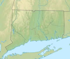
Burley Hill (Connecticut)
| Burley Hill | |
|---|---|
| Highest point | |
| Elevation | 1,316 ft (401 m)[1] |
| Coordinates | 42°01′01″N 72°12′31″W / 42.0170402°N 72.2086891°W[1] |
| Geography | |
| Location | Union, Connecticut |
| Climbing | |
| Easiest route | Private road, bushwack |
Burley Hill is a 1,316-foot (401 m) hill in Union, Connecticut. It is the highest point in Tolland County and the highest point in eastern Connecticut.[2] It is one of Connecticut's highest named summits[3] and it ranks 6th in the state for prominence at 669 feet (204 m).[4]
It is the most isolated peak in Connecticut and ranks 47th out of 50 for separation. The nearest summit above 1316' is 1387' Asnebumskit Hill in Massachusetts, 25.2 miles (40.6 km) away.[5]
References
[edit]- ^ a b "Burley Hill". Geographic Names Information System. United States Geological Survey, United States Department of the Interior.
- ^ "History of Connecticut Through 1690". Yale-New Haven Teachers Institute.
- ^ "Connecticut Highest Named Summits". America's Roof. Archived from the original on August 13, 2012. Retrieved June 15, 2012.
- ^ "Connecticut and Rhode Island, P300, All hills with 300 ft of more of prominence". Peakist.org.
- ^ "Burley Hill, Connecticut". Peakbagger.com.
External links
[edit]- Topographical Map TopoZone
- 8/16/08 Tolland County, CT: Burley Hill Roadrogue Trip Report


 French
 Deutsch