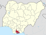
Ikwerre, Rivers
Ikwerre | |
|---|---|
| Coordinates: 5°1′23″N 6°52′50″E / 5.02306°N 6.88056°E | |
| Country | Nigeria |
| State | Rivers State |
| Date created | 1991 |
| Seat | Isiokpo |
| Area | |
• Total | 530 sq mi (1,380 km2) |
| Time zone | UTC+1 (WAT) |
 | |
Ikwerre [1] is a Local Government Area in Rivers State, Nigeria. Its headquarters is in the town of Isiokpo 'known as the ancient Kingdom of Ikwerre land'.[citation needed] It is the first Iwuhuohna local government and later Emohua, Obio/Akpor and Port Harcourt LGAs were created.[citation needed] The Ikwerre tribe occupies the upland region of Rivers State. It shares boundaries with Imo State to the north, Emohua to the west, Etche to the east, and Obio-Akpor to the south.[citation needed]
The postal code of the area is 511001.[2]
Climate/Geography
[edit]Ikwerre LGA has an average annual temperature of 26 degrees Celsius and a total size of 1,380 square kilometers. The Lower Gulch Area experiences two distinct seasons—the dry and the rainy—with an average humidity level of 90%. In Ikwerre LGA, the wet seasons are distinguished by prolonged precipitation and typically persist longer than the dry ones.[3][4]
Town and Communities
References
[edit]- ^ "Collections Online | British Museum". www.britishmuseum.org. Retrieved 2024-06-28.
- ^ "Post Offices- with map of LGA". NIPOST. Archived from the original on 2009-10-07. Retrieved 2009-10-20.
- ^ "Ikwerre Local Government Area". www.manpower.com.ng. Retrieved 2024-08-10.
- ^ "Ikwerre, Nigeria Hourly Weather Forecast | Weather Underground". www.wunderground.com. Retrieved 2024-08-10.
- ^ Ikunga, Solomon (2018). "7". In Bassey Anam (ed.). "The Development of Indigenous Technology in Iwhuruohna 1500-2000: A Historical Imperative". Arts, Technology & Development Patterns. Nigeria: Advanced Publishers. pp. 87–114. ISBN 978-051-062-1.


 French
 Deutsch

