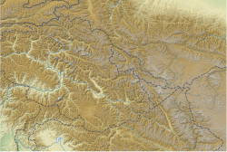
K12 (mountain)

K12
K12 is located in Ladakh
K12
K12
K12 (Ladakh)
K12 is located in Gilgit Baltistan
K12
K12
K12 (Gilgit Baltistan)
Map
About OpenStreetMaps
Maps: terms of use
45km
30miles
Pakistan
India
China
Gasherbrum V
48
Gasherbrum V
Rimo III
Rimo III
Apsarasas Kangri I
Apsarasas Kangri I
Diran
Diran
Muztagh Tower
Muztagh Tower
K6
K6
Yutmaru Sar
Yutmaru Sar
Baintha Brakk
Baintha Brakk
Crown Peak
Crown Peak
Baltoro Kangri
Baltoro Kangri
Yazghil Dome South
Yazghil Dome South
Sherpi Kangri
Sherpi Kangri
Rimo I, Rimo massif
Rimo I, Rimo massif
Ultar, Ultar Peak, Ultar Sar
Ghent Kangri
Ghent Kangri
Haramosh Peak
Haramosh Peak
Skil Brum
Skil Brum
Momhil Sar
Momhil Sar
Sia Kangri
Sia Kangri
K12
K12
Malubiting
Malubiting
Teram Kangri I
Teram Kangri I
Yukshin Gardan Sar
Yukshin Gardan Sar
Passu Sar
Passu Sar
Pumari Chhish
Pumari Chhish
Saser Kangri III
Saser Kangri III
Saser Kangri II
Saser Kangri II
Mamostong Kangri K35
Skyang Kangri
Skyang Kangri
Trivor Sar
Trivor Sar
Shispare or Shispare Sar
Chogolisa
Chogolisa
Saser Kangri I, K22
Saser Kangri I, K22
Batura III
Batura III
Saltoro Kangri, K10
Saltoro Kangri, K10
Kanjut Sar
Kanjut Sar
Batura II
Batura II
Rakaposhi
Rakaposhi
Batura Sar, Batura I
Masherbrum, K1
9
Masherbrum, K1
Kunyang Chhish (Kunyang Kish, Khunyang Chhish, Khinyang Chhish)
8
Kunyang Chhish (Kunyang Kish, Khunyang Chhish, Khinyang Chhish)
Distaghil Sar
7
Distaghil Sar
Gasherbrum IV, K3
6
Gasherbrum IV, K3
Gasherbrum III, K3a
5
Gasherbrum III, K3a
Gasherbrum II, K4
4
Gasherbrum II, K4
Broad Peak
3
Broad Peak
Gasherbrum I, K5
2
Gasherbrum I, K5
K2
1
K2
The major peaks in Karakoram are rank identified by height.

Legend:
1:K22:Gasherbrum I, K53:Broad Peak4:Gasherbrum II, K45:Gasherbrum III, K3a6:Gasherbrum IV, K37:Distaghil Sar8:Kunyang Chhish9:Masherbrum, K110:Batura Sar, Batura I11:Rakaposhi12:Batura II13:Kanjut Sar14:Saltoro Kangri, K1015:Batura III16: Saser Kangri I, K2217:Chogolisa18:Shispare19:Trivor Sar20:Skyang Kangri21:Mamostong Kangri, K3522:Saser Kangri II23:Saser Kangri III24:Pumari Chhish25:Passu Sar26:Yukshin Gardan Sar27:Teram Kangri I28:Malubiting29:K1230:Sia Kangri31:Momhil Sar32:Skil Brum33:Haramosh Peak34:Ghent Kangri35:Ultar Sar36:Rimo massif37:Sherpi Kangri38:Yazghil Dome South39:Baltoro Kangri40:Crown Peak41:Baintha Brakk42:Yutmaru Sar43:K644:Muztagh Tower45:Diran46:Apsarasas Kangri I47:Rimo III48:Gasherbrum V

 
Highest point
Elevation7,428 m (24,370 ft)[1][2]
Ranked 61st
Prominence1,978 m (6,490 ft)[2]
ListingUltra
Coordinates35°17′42″N 77°01′18″E / 35.29500°N 77.02167°E / 35.29500; 77.02167[2]
Geography
LocationSaltoro Ridge, Siachen, Actual Ground Position Line
Parent rangeSaltoro Mountains, Karakoram
Climbing
First ascent1974 by Shinichi Takagi, Tsutomu Ito (Japanese)
Easiest routesnow/ice climb

K12 is the second highest peak in the Saltoro Mountains, a subrange of the Karakoram range in the Siachen region and is administered as a part of Ladakh territory. Its name comes from its designation given during the original survey of the Karakoram range. In 1984, an Indian army expedition under Colonel Prem Chand took hold of this peak, from the side of Siachen glacier by traversing from the west.[3]

K12 lies to the southwest of the Siachen Glacier; the K12 glacier heads on its northeast slopes and feeds the Siachen. The western slopes of K12 drain to the Bilafond Glacier system, and thence to the Dansam River, and eventually the Indus River.

K12 was used for training for the Mount Everest expedition of the Indian Army in 1985.[4] Apart from this, K12 has seen little climbing activity, partly because of the unsettled political situation and the continued military presence in the area linked to the Siachen conflict. It was first attempted in 1960, after a reconnaissance visit by famed explorer Eric Shipton in 1957. After a further unsuccessful attempt by a Japanese party in 1971, another Japanese expedition put two climbers, Shinichi Takagi and Tsutomu Ito, on the summit. They fell and died on the descent, and their bodies were not recovered. Another Japanese expedition returned in 1975 and made the second ascent.[4]

See also

[edit]

References

[edit]
  1. ^ "Topographic map of K12". opentopomap.org. Retrieved 2023-06-19.
  2. ^ a b c "High Asia I: The Karakoram, Pakistan Himalaya and India Himalaya (north of Nepal)". Peaklist.org. Retrieved 2014-05-27.
  3. ^ Kapadia, Harish (1999). Across Peaks & Passes in Ladakh, Zanskar & East Karakoram. ISBN 9788173871009.
  4. ^ a b "Ascent of K12 (7428 m) in Saltoro Hills (Range)". Himalayan Journal. 41. The Himalayan Club. 1985. Retrieved 2020-06-15.

Sources

[edit]
  • Wala, Jerzy (1990). Orographical Sketch Map of the Karakoram (Map). Swiss Foundation for Alpine Research.
  • Neate, Jill (1989). High Asia: an illustrated history of the 7,000 metre peaks. The Mountaineers.