Nij Altoenae
Nij Altoenae | |
|---|---|
Village | |
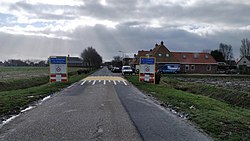
 Welcome to Nij Altoenae | |
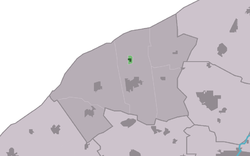
 Location in het Bildt municipality | |
| Coordinates: 53°17′44″N 5°39′11″E / 53.29556°N 5.65306°E | |
| Country | Netherlands |
| Province | Friesland |
| Municipality | Waadhoeke |
| Area | |
• Total | 0.17 km2 (0.07 sq mi) |
| Elevation | 1.4 m (4.6 ft) |
| Population (2021)[1] | |
• Total | 325 |
| • Density | 1,900/km2 (5,000/sq mi) |
| Postal code | 9072[1] |
| Dialing code | 0518 |
| Website | www |
Nij Altoenae[a] (Dutch: [nɛi ˈɑltunaː]; West Frisian: Nij Altena) is a village in Waadhoeke municipality in the province of Friesland, the Netherlands. It had a population of around 300 in January 2017.[3]
History
[edit]The village was first mentioned in 1958 as Nij-Altoenae. Nij (new) was added to distinguish between Altoenae. Altoenae was the former name of Sint Annaparochie which was named after the estate Altena near Delft, the neighbourhood where Dirk Oem van Wijngaarden, one of the first settlers, grew up.[4] The village used to be call 't Wegje and had the status of a hamlet.[5]
The Reformed Church was built in 1918. In 1928, a new church was built in a different location. The old church was sold, and is nowadays used as a shed. The new church was renovated in 2012.[5]
In 2006, Nij Altoenae became a village. Until 2018, the village was part of het Bildt municipality.[5]
Gallery
[edit]- Church between the dikes
Notes
[edit]References
[edit]- ^ a b c "Kerncijfers wijken en buurten 2021". Central Bureau of Statistics. Retrieved 4 April 2022.
- ^ "Postcodetool for 9072AA". Actueel Hoogtebestand Nederland (in Dutch). Het Waterschapshuis. Retrieved 4 April 2022.
- ^ Kerncijfers wijken en buurten 2017 - CGB Statline
- ^ "Nij Altoenae - (geografische naam)". Etymologiebank (in Dutch). Retrieved 4 April 2022.
- ^ a b c "Nij Altoenae". Plaatsengids (in Dutch). Retrieved 4 April 2022.
External links
[edit] Media related to Nij Altoenae at Wikimedia Commons
- website about Altena


 French
 Deutsch

