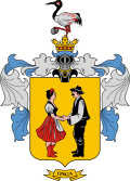
Onga, Hungary
Onga | |
|---|---|
 Location of Borsod-Abaúj-Zemplén county in Hungary | |
| Coordinates: 48°07′08″N 20°54′26″E / 48.11899°N 20.90735°E | |
| Country | |
| County | Borsod-Abaúj-Zemplén |
| District | Miskolc |
| Area | |
• Total | 31.49 km2 (12.16 sq mi) |
| Population (2015.jan.1.) | |
• Total | 4,746 |
| • Density | 151.63/km2 (392.7/sq mi) |
| Time zone | UTC+1 (CET) |
| • Summer (DST) | UTC+2 (CEST) |
| Postal code | 3562 |
| Area code | (+36) 46 |
| Website | www |
Onga is a village in Borsod-Abaúj-Zemplén County, Hungary. 10 km to Miskolc.
History
[edit]The area has been inhabited since prehistoric times, this Bronze Age artifacts attest. 1222 was first mentioned. In 1588 the Turks burned, but quickly built up again. The village suffered a lot during the Turkish period and the Rákóczi War of Independence, the 18th century began to grow again. The population lived mainly in farming.
In the 19th century, the development has accelerated, thanks to the railways and county seat closeness. Increase in the number of industrial workers. The development accelerated after the Second World War. Ócsanálos village attached to Onga, in 1950.
June 4, 2011, inauguration of the township's runic-name plate.[1]
The settlement received a city title on the 15th of July 2013, the proposal of the Minister of Public Administration and Justice.
Ethnic groups
[edit]The town's population, 83% of Hungarian and 17% of Roma.[2]
Population
[edit]The change in the town's population:
- in 2013: 4857 inhabitant
- in 2014: 4778 inhabitant
- in 2015: 4746 inhabitant
Graphs are unavailable due to technical issues. Updates on reimplementing the Graph extension, which will be known as the Chart extension, can be found on Phabricator and on MediaWiki.org. |
References
[edit]- ^ "Hírek Archívum | Rovás Infó". Rovás Infó (in Hungarian). Archived from the original on 2014-11-09. Retrieved 2016-09-24.
- ^ "Központi Statisztikai Hivatal". www.ksh.hu. Retrieved 2016-09-24.
External links
[edit]- Official website in Hungarian, English and Slovak
- Street map (in Hungarian)


 French
 Deutsch


