Berlin Schönhauser Allee station
 | ||||||||||||||||||||||||||||||||||||
| General information | ||||||||||||||||||||||||||||||||||||
| Owned by | DB Netz | |||||||||||||||||||||||||||||||||||
| Operated by | DB Station&Service | |||||||||||||||||||||||||||||||||||
| Line(s) | Ringbahn | |||||||||||||||||||||||||||||||||||
| Platforms | 1 island platform | |||||||||||||||||||||||||||||||||||
| Tracks | 2 | |||||||||||||||||||||||||||||||||||
| Connections | ||||||||||||||||||||||||||||||||||||
| Construction | ||||||||||||||||||||||||||||||||||||
| Structure type | Below grade (S-Bahn) Elevated (U-bahn) | |||||||||||||||||||||||||||||||||||
| Other information | ||||||||||||||||||||||||||||||||||||
| Fare zone | VBB: Berlin A/5555[1] | |||||||||||||||||||||||||||||||||||
| Services | ||||||||||||||||||||||||||||||||||||
| ||||||||||||||||||||||||||||||||||||
 | ||||||||||||||||||||||||||||||||||||
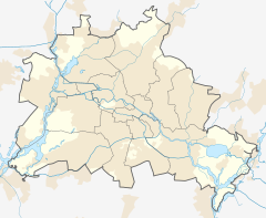
Berlin Schönhauser Allee is a railway station in the Prenzlauer Berg district of Berlin. It is located on the Berlin U-Bahn line U2 and also on the Ringbahn (Berlin S-Bahn). Built in 1913 by A.Grenander opened as "Bahnhof Nordring". As the station was well accepted the roof was elongated in 1925 and a new entrance built. In 1936 the station was named "Schönhauser Allee". On an average day approximately 500 trains and more than 26000 people cross this station.[2]
At this station, the elevated U2 crosses the below-ground S-Bahn, while at the other crossing of the U2 and the Ringbahn, Messe-Nord/ICC S-Bahn station and Kaiserdamm U2 station, the U2 crosses S-Bahn below-ground on the bottom deck of a road bridge.[3]
- U-Bahn platforms at Schönhauser Allee
- Platform
References
[edit]- ^ "Der VBB-Tarif: Aufteilung des Verbundgebietes in Tarifwaben und Tarifbereiche" (PDF). Verkehrsbetrieb Potsdam. Verkehrsverbund Berlin-Brandenburg. 1 January 2017. Archived from the original (PDF) on 27 October 2020. Retrieved 25 November 2019.
- ^ J. Meyer-Kronthaler: Berlins U-Bahnhöfe. be.bra Verlag (1996)
- ^ Robert Schwandl: U-Bahn, S-Bahn and tram in Berlin. (2014)


 French
 Deutsch

