El Monte, California - Simple English Wikipedia, the free encyclopedia
El Monte, California | |
|---|---|
 | |
| Nickname: "The End of the Santa Fe Trail" | |
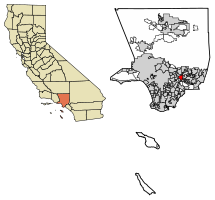
 Location of El Monte in Los Angeles County, California | |
| Coordinates: 34°4′24″N 118°1′39″W / 34.07333°N 118.02750°W | |
| Country | |
| State | |
| County | Los Angeles |
| Incorporated | November 18, 1912[1] |
| Area | |
| • Total | 9.65 sq mi (24.99 km2) |
| • Land | 9.56 sq mi (24.77 km2) |
| • Water | 0.09 sq mi (0.22 km2) |
| Elevation | 299 ft (91 m) |
| Population | |
| • Total | 109,450 |
| • Rank | 12th in Los Angeles County 64th in California |
| • Density | 11,342/sq mi (4,380/km2) |
| Time zone | UTC−8 (Pacific) |
| • Summer (DST) | UTC−7 (PDT) |
| ZIP Codes | 91731–91735 |
| Area code | 626 |
| FIPS code | 06-22230 |
| GNIS feature IDs | 1652702, 2410413 |
| Website | elmonteca |
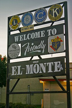
El Monte is a city in Los Angeles County, California. It is in the San Gabriel Valley, east of Los Angeles. At the 2020 census, 109,450 lived there. This was lower than the 2010 census, when 113,475 people lived there.[4] The city was first incorporated in 1912. Its name means "the mountain" in Spanish.[5][6]
References
[change | change source]- ↑ "California Cities by Incorporation Date". California Association of Local Agency Formation Commissions. Archived from the original (Word) on November 3, 2014. Retrieved August 25, 2014.
- ↑ "2019 U.S. Gazetteer Files". United States Census Bureau. Retrieved July 1, 2020.
- ↑ "El Monte". Geographic Names Information System. United States Geological Survey. Retrieved January 30, 2015.
- ↑ 4.0 4.1 "El Monte (city) QuickFacts". United States Census Bureau. Retrieved March 9, 2022.
- ↑ "Population and Housing Unit Estimates". United States Census Bureau. May 24, 2020. Retrieved May 27, 2020.
- ↑ "Census of Population and Housing". Census.gov. Retrieved June 4, 2015.


 French
 Deutsch


